
SH.005-0
Kanach Tala Cemetery
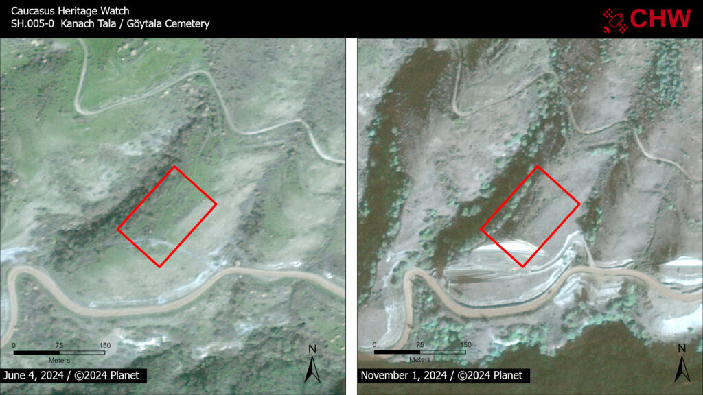
Before Image Date: June 4, 2024
Impact Image Date: November 1, 2024
There is very little information about this cemetery, dated to the 19th and 20th centuries. The extent of the cemetery is marked on a 1952 1:25,000 topographic map of the region. The more recent tombs are clearly visible in modern satellite imagery in the northern sector of the cemetery. The older tombs are reported to have been embedded in the ground surface and thus are not visible in satellite imagery.
Impact to the cemetery is first visible in an October 5, 2023 image that shows the initial earthwork for what would subsequently emerge in later imagery as a terrace intended to stabilize the slope above a new roadway. As of the most recent imagery, the terrace construction has impacted approximately 16% of the recorded territory of the cemetery.