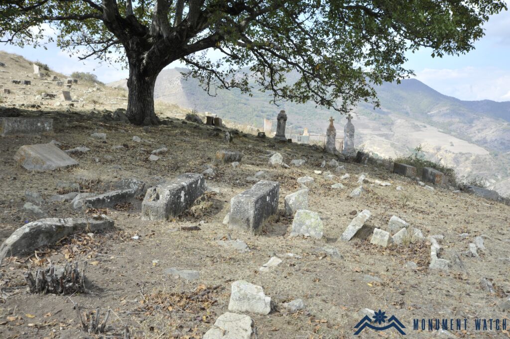
SH.026-0
Parin Pizh Cemetery
Damaged
Cemetery
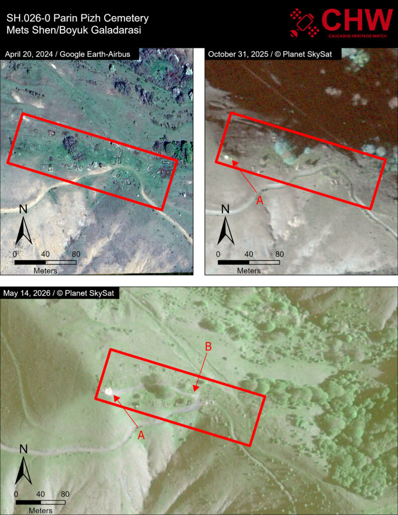
Before Image Date: October 31, 2025
Impact Image Date: May 14, 2026
Satellite imagery shows both demolition and earth clearing in the area of Parin Pizh cemetery. The cemetery is clearly visible in Google Earth high-resolution imagery from April 2024. A Skysat image from October 31, 2025 indicates the beginning of what appears to be a localized demolition project marked by arrow A. By May 2026, the demolition project seems to have gotten larger (arrow A) and has been joined by a bulldozed or graded path that cuts through the cemetery from the pre-existing road (arrow B) to the demolition site, damaging several tombs.
Metadata