
HT.069-1
Mets T’agher Cemetery
Destroyed
Cemetery
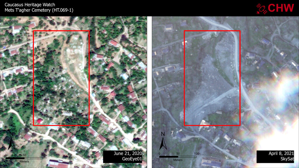
Before Image Date: June 21, 2020
Impact Image Date: April 8, 2021
The area of this cemetery has been deeply graded with bull dozer scars clearly visible in the April 9, 2021 image. A subsequent image capture from May 16, 2021 shows continued destruction in the area as earth and funerary materials have been pushed into a large berm adjacent to the new road construction.